Jeux de données

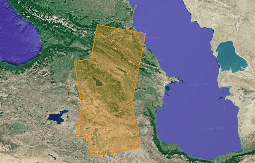
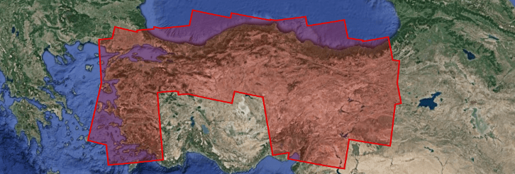
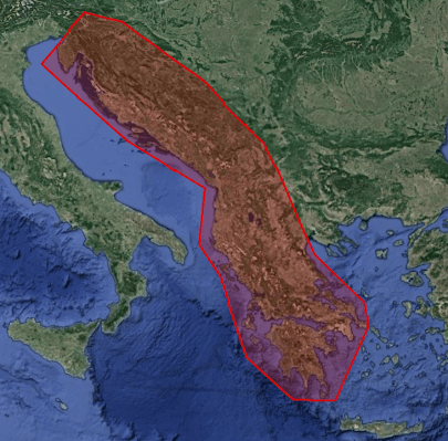
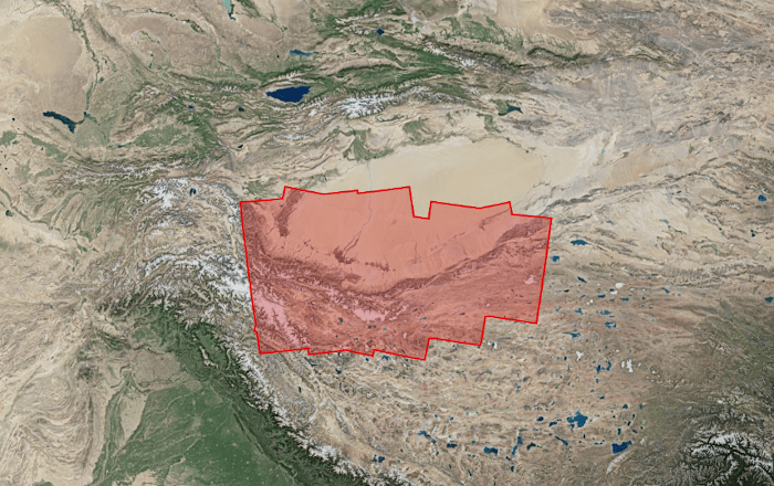
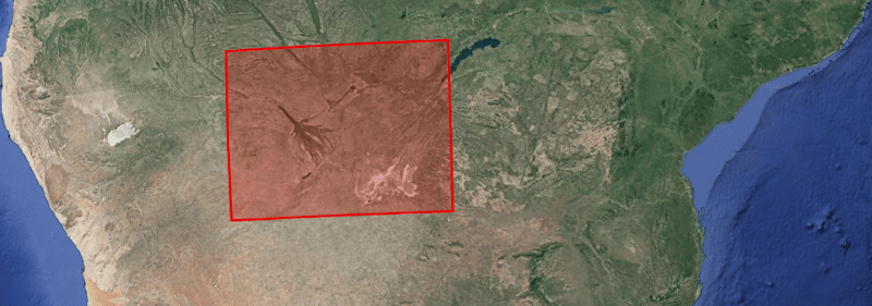
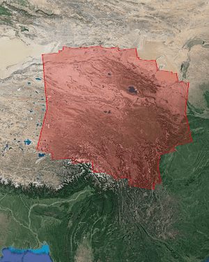
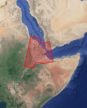
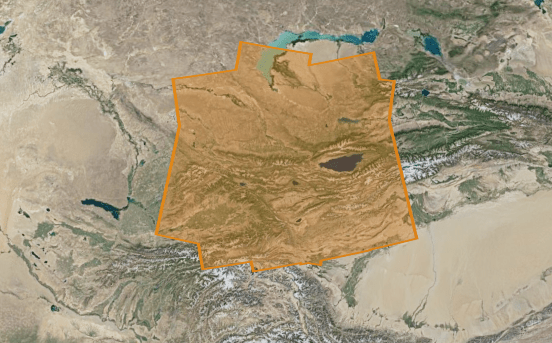
Tian Shan – InSAR FLATSIM : Ground Deformation products

This dataset provides high-precision measurements of surface displacements for the Tian Shan area. The data is generated using the FLATSIM processing chain, designed for consistent and systematic INSAR analysis at […]

South Mexico – InSAR FLATSIM : Ground Deformation products

This dataset provides high-precision measurements of surface displacements for the South Mexico area. The data is generated using the FLATSIM processing chain, designed for consistent and systematic INSAR analysis at […]

Mozambique – InSAR FLATSIM : Ground Deformation products

This dataset provides high-precision measurements of surface displacements for the Mozambique area. The data is generated using the FLATSIM processing chain, designed for consistent and systematic INSAR analysis at large […]

Makran – InSAR FLATSIM : Ground Deformation products

This dataset provides high-precision measurements of surface displacements for the Makran area. The data is generated using the FLATSIM processing chain, designed for consistent and systematic INSAR analysis at large […]

Maghreb – InSAR FLATSIM : Ground Deformation products

This dataset provides high-precision measurements of surface displacements for the Maghreb area. The data is generated using the FLATSIM processing chain, designed for consistent and systematic INSAR analysis at large […]

Levant – InSAR FLATSIM : Ground Deformation products

This dataset provides high-precision measurements of surface displacements for the Levant area. The data is generated using the FLATSIM processing chain, designed for consistent and systematic INSAR analysis at large […]

Himalaya and western Tibet – InSAR FLATSIM : Ground Deformation products

This dataset provides high-precision measurements of surface displacements for the Himalaya and western Tibet area. The data is generated using the FLATSIM processing chain, designed for consistent and systematic INSAR […]

Central Chile – InSAR FLATSIM : Ground Deformation products

This dataset provides high-precision measurements of surface displacements for the Central Chile area. The data is generated using the FLATSIM processing chain, designed for consistent and systematic INSAR analysis at […]

Caucasus – InSAR FLATSIM : Ground Deformation products

This dataset provides high-precision measurements of surface displacements for the Caucasus area. The data is generated using the FLATSIM processing chain, designed for consistent and systematic INSAR analysis at large […]

Turkey – InSAR FLATSIM : Ground Deformation products

This dataset provides high-precision measurements of surface displacements for the Turkey area. The data is generated using the FLATSIM processing chain, designed for consistent and systematic INSAR analysis at large […]

The Balkan region – InSAR FLATSIM : Ground Deformation products

This dataset provides high-precision measurements of surface displacements for the Balkan region. The data is generated using the FLATSIM processing chain, designed for consistent and systematic INSAR analysis at large […]

Tarim – InSAR FLATSIM : Ground Deformation products

This dataset provides high-precision measurements of surface displacements for the Tarim area. The data is generated using the FLATSIM processing chain, designed for consistent and systematic INSAR analysis at large […]

Okavango Delta – InSAR FLATSIM : Ground Deformation products

This dataset provides high-precision measurements of surface displacements for the Okavango Delta area. The data is generated using the FLATSIM processing chain, designed for consistent and systematic INSAR analysis at […]

Eastern border of the Tibetan plateau – InSAR FLATSIM : Ground Deformation products

This dataset provides high-precision measurements of surface displacements for the Eastern border of the Tibetan plateau. The data is generated using the FLATSIM processing chain, designed for consistent and systematic […]

Ozark aquifer – InSAR FLATSIM : Ground Deformation products

This dataset provides high-precision measurements of surface displacements for the Ozark aquifer area. The data is generated using the FLATSIM processing chain, designed for consistent and systematic INSAR analysis at […]

Central Andes, Peru Chile – InSAR FLATSIM : Ground Deformation products

This dataset provides high-precision measurements of surface displacements for the central Andes, Peru-Chile area. The data is generated using the FLATSIM processing chain, designed for consistent and systematic INSAR analysis […]

Sentinel-1 Level 1- S1 Tiling

S1TILING L1 products are based on Sentinel-1 Level-1 Ground Range Detected (GRD) products which are ortho-rectified on Sentinel-2 grid to promote joint use of both missions. These products are supplied […]

SPOT4_HRVIR_XS_20130618_N2A_CTunisieD0000B0000

Take5 Spot4 Level 1C

At the end of life of each satellite, CNES issues a call for ideas for short-term experiments taking place before de-orbiting the satellite. In 2012, CESBIO seized the opportunity to […]

VENUS VM5 L3A

The products of level 3A provide a monthly synthesis of surface reflectances from Theia’s L2A products. The synthesis is based on a weighted arithmetic mean of clear observations. The data […]

SPOT4_HRVIR_XS_20130618_N2A_CTunisieD0000B0000

Take5 Spot5 Level 2A

At the end of life of each satellite, CNES issues a call for ideas for short-term experiments taking place before de-orbiting the satellite. Based on the success of SPOT4 (Take5), […]

SWH SPOT1 L1C

The Spot World Heritage Service opened in June 2015 with the first dataset about France. Two large areas are covered, between 1986 and 2015  : Multispectral images* covering metropolitan France […]

SWH SPOT2 L1C

The Spot World Heritage Service opened in June 2015 with the first dataset about France. Two large areas are covered, between 1986 and 2015  : Multispectral images* covering metropolitan France […]

SPOT4_HRVIR_XS_20130618_N2A_CTunisieD0000B0000

Take5 Spot5 Level 1C

At the end of life of each satellite, CNES issues a call for ideas for short-term experiments taking place before de-orbiting the satellite. Based on the success of SPOT4 (Take5), […]

VENUS VM1 L3A

The products of level 3A provide a monthly synthesis of surface reflectances from Theia’s L2A products. The synthesis is based on a weighted arithmetic mean of clear observations. The data […]

SWH SPOT4 L1C

The Spot World Heritage Service opened in June 2015 with the first dataset about France. Two large areas are covered, between 1986 and 2015  : Multispectral images* covering metropolitan France […]

SWH SPOT4 L1A

Le produit SWH 1A correspond au produit historique SPOT scène 1A au format DIMAP (GeoTIFF + métadonnées XML). Il s’agit du premier produit image avec une correction radiométrique qui égalise […]

POSTEL Vegetation NDVI

The “continental vegetation and soils” biogeophysical products of Postel are spatialized variables derived from optical or micro-wave sensors measurements acquired over many years at regional to global scales. Postel Vegetation […]

POSTEL Downwelling Longwave Radiation

The “radiation” biogeophysical products of Postel are spatialized variables derived from optical or micro-wave sensors measurements acquired over many years at regional to global scales. The Downwelling Longwave Radiation (W.m-2) […]

SENTINEL2 BIOPHY L2B

Variables biophysiques caractéristiques de la végétation : Le LAI et le fAPAR sont reconnues comme des ECVs (Essential Climate Variables) par le Global Climate Observing System – GCOS). Plus d’informations https://www.theia-land.fr/en/blog/product/vegetation-variables […]

OSO (Occupation des Sols ) RASTER L3B

Main characteristics of the OSO Land Cover product : Production of national maps (mainland France)Nomenclature with 17 classes (2016, 2017) and 23 classes since 2018, spatial resolution between 10 m […]

Water Quality SENTINEL2 L2B

The processing chain outputs rasters of the concentration of SPM estimated in the Bands B4 and B8. The concentration is given in mg/L. So a pixel value of 21.34 corresponds […]

POSTEL Vegetation FAPAR

Les produits du Centre Thématique Postel (2000-2008) au sein du Groupement d’Intérêt Public Medias-France sont principalement des produits à valeur ajoutée à l’échelle globale obtenus à partir de différents capteurs […]

SWH SPOT1-2-3 L1A

Le produit SWH 1A correspond au produit historique SPOT scène 1A au format DIMAP (GeoTIFF + métadonnées XML). Il s’agit du premier produit image avec une correction radiométrique qui égalise […]

Afar – InSAR FLATSIM : Ground Deformation products

This dataset provides high-precision measurements of surface displacements for the AFAR area. The data is generated using the FLATSIM processing chain, designed for consistent and systematic INSAR analysis at large […]

POSTEL Radiation Surface Albedo

Les produits Postel bio-géophysiques « variables de rayonnement » sont des variables spatialisées issues de mesures de capteurs optique et micro-onde, de moyenne résolution spatiale, acquises sur plusieurs années aux […]

POSTEL Radiation Surface Reflectance

Les produits Postel bio-géophysiques « variables de rayonnement » sont des variables spatialisées issues de mesures de capteurs optique et micro-onde, de moyenne résolution spatiale, acquises sur plusieurs années aux […]

Spirit Spot 5 Level 1A

SPOT 5 stereoscopic survey of Polar Ice.Les objectifs du projet SPIRIT étaient de constituer une importante archive d’images Spot 5 HRS sur les glaces polaires et, pour certaines régions, de […]

POSTEL Vegetation Surface Reflectance

Les produits du Centre Thématique Postel (2000-2008) au sein du Groupement d’Intérêt Public Medias-France sont principalement des produits à valeur ajoutée à l’échelle globale obtenus à partir de différents capteurs […]

POSTEL Water Precipitation

Les produits Postel bio-géophysiques « cycle de l’eau » sont des variables spatialisées issues de mesures de capteurs optique et micro-onde, de moyenne résolution spatiale, acquises sur plusieurs années aux […]

POSTEL Water Surface Wetness

Les produits Postel bio-géophysiques « cycle de l’eau » issus de Postel sont des variables spatialisées issues de mesures de capteurs optique et micro-onde, de moyenne résolution spatiale, acquises sur […]

POSTEL Vegetation FCOVER

A land cover map associates to each pixel of the surface a labelling characterizing the surface (ex : deciduous forest, agriculture area, etc) following a predefined nomenclature. A commonly used […]

POSTEL Landcover Globcover

A land cover map associates to each pixel of the surface a labelling characterizing the surface (ex : deciduous forest, agriculture area, etc) following a predefined nomenclature. A commonly used […]

POSTEL Radiation BRDF

Les produits Postel bio-géophysiques « variables de rayonnement » sont des variables spatialisées issues de mesures de capteurs optique et micro-onde, de moyenne résolution spatiale, acquises sur plusieurs années aux […]

LANDSAT-5 L2A

Data ortho-rectified surface reflectance after atmospheric correction, along with a mask of clouds and their shadows, as well as a mask of water and snow.The processing methods and the data […]

OSO (Occupation des Sols ) VECTOR L3B

Main characteristics of the OSO Land Cover product : Production of national maps (mainland France) Nomenclature with 17 classes (2016, 2017) and 23 classes since 2018, spatial resolution between 10 […]

POSTEL WATER SOILMOISTURE

Les produits Postel bio-géophysiques « cycle de l’eau » sont des variables spatialisées issues de mesures de capteurs optique et micro-onde, de moyenne résolution spatiale, acquises sur plusieurs années aux […]

SWH SPOT5 L1C

The Spot World Heritage Service opened in June 2015 with the first dataset about France. Two large areas are covered, between 1986 and 2015  : Multispectral images covering metropolitan France […]

SWH SPOT5 L1A

Le produit SWH 1A correspond au produit historique SPOT scène 1A au format DIMAP (GeoTIFF + métadonnées XML). Il s’agit du premier produit image avec une correction radiométrique qui égalise […]

VENUS VM1 L1C

The L1C product contains 2 files : one with the metadata giving information on image acquisition (Instrument, date and time– projection and geographic coverage– Solar and viewing angles), and the […]

LANDSAT-7 L2A

Data ortho-rectified surface reflectance after atmospheric correction, along with a mask of clouds and their shadows, as well as a mask of water and snow.The processing methods and the data […]

SWH SPOT3 L1C

The Spot World Heritage Service opened in June 2015 with the first dataset about France. Two large areas are covered, between 1986 and 2015  : Multispectral images covering metropolitan France […]

LANDSAT-8 L2A

The level 2A products correct the data for atmospheric effects along with a mask of clouds and their shadows, as well as a mask of water and snow.Landsat products are […]

VENUS VM5 L2A

The level 2A products correct the data for atmospheric effects and detect the clouds and their shadows. Data is processed by MAJA for THEIA land data center. Plus d’informations Sites […]

Sentinel-2 Level 3A

The products of level 3A provide a monthly synthesis of surface reflectances from Theia’s L2A products. The synthesis is based on a weighted arithmetic mean of clear observations. Plus d’informations […]

VENUS VM1 L2A

The level 2A products correct the data for atmospheric effects and detect the clouds and their shadows. Data is processed by MAJA for THEIA land data center. Plus d’informations Sites […]

SPOT4_HRVIR_XS_20130618_N2A_CTunisieD0000B0000

Take5 Spot4 Level 2A

At the end of life of each satellite, CNES issues a call for ideas for short-term experiments taking place before de-orbiting the satellite. In 2012, CESBIO seized the opportunity to […]

POSTEL Vegetation LAI

Les produits du Centre Thématique Postel (2000-2008) au sein du Groupement d’Intérêt Public Medias-France sont principalement des produits à valeur ajoutée à l’échelle globale obtenus à partir de différents capteurs […]

VENUS VM5 L1C

The L1C product contains 2 files : one with the metadata giving information on image acquisition (Instrument, date and time– projection and geographic coverage– Solar and viewing angles), and the […]

POSTEL Water Soil Water Index

Les produits Postel bio-géophysiques « cycle de l’eau » sont des variables spatialisées issues de mesures de capteurs optique et micro-onde, de moyenne résolution spatiale, acquises sur plusieurs années aux […]

Sentinel-3 Level 1

The main objective of the Sentinel-3 mission is to measuresea surface topography, sea and land surface temperature, and ocean and land surface colour with high accuracy and reliability to support […]

Sentinel-1 Level 1

Sentinel-1 Level-1 products are the baseline products for the majority of users from which higher levels are derived. From data in each acquisition mode, the Instrument Processing Facility (IPF)  generates […]

Sentinel-2 Level 1C

A Sentinel-2 Level-1C Collection 1 product provides orthorectified Top-Of-Atmosphere (TOA) reflectance, with sub-pixel multispectral and multitemporal registration accuracy. Technical quality masks, cloud and land/water are included in the product. The […]

Sentinel-1 Level 2

Sentinel-1 Level-2 consists of geolocated geophysical products derived from Level-1. There is only one standard Level-2 product for wind, wave and currents applications – the Level-2 Ocean (OCN) product. The […]

Sentinel-2 Level 2A

The level 2A products correct the data for atmospheric effects and detect the clouds and their shadows.Data is processed by MAJA for THEIA land data center Plus d’informations https://www.cesbio.cnrs.fr/multitemp/sentinel-2/theias-sentinel-2-l2a-product-format/#English Caractéristiques […]

Modèle de dealiasing atmosphérique à 10 jours OMP de niveau 2A

Description des solutions Les produits de desaliasing ERA-Interim et TUGO permettent d’estimer les variations spatiales et temporelles du potentiel gravitationnel de l’atmosphère (ERA-Interim) et de l’océan (TUGO) en 3D. La […]

Modèle de dealiasing atmosphérique mensuel OMP de niveau 2A

Description des solutions Les produits de desaliasing ERA-Interim et TUGO permettent d’estimer les variations spatiales et temporelles du potentiel gravitationnel de l’atmosphère (ERA-Interim) et de l’océan (TUGO) en 3D. La […]

Modèle de dealiasing océanique à 10 jours OMP de niveau 2A

Description des solutions Les produits de désaliasing ERA-Interim et TUGO dealiasing permettent d’estimer  les variations spatiales et temporelles du potentiel gravitationnel de l’atmosphère et de l’océan en 3Ds. La valeur […]

Modèle de dealiasing océanique mensuel OMP de niveau 2A

Description des solutions Les produits de désaliasing ERA-Interim et TUGO dealiasing permettent d’estimer  les variations spatiales et temporelles du potentiel gravitationnel de l’atmosphère et de l’océan en 3Ds. La valeur […]

Solutions CNES GRACE/-FO de niveau 2A des anomalies mensuelles du géopotentiel contraintes par décomposition en valeurs singulières

Description des solutions Les missions GRACE and GRACE-FO Les missions de gravimétrie satellite GRACE (Gravity Recovery And Climate Experiment; Tapley et al., 2004; Tapley et al., 2019) et GRACE-FO (GRACE […]

Solutions CNES GRACE/-FO de niveau 2A des anomalies à 10 jours du géopotentiel contraintes par décomposition en valeurs singulières

Description des solutions Les missions GRACE and GRACE-FO Les missions de gravimétrie satellite GRACE (Gravity Recovery And Climate Experiment; Tapley et al., 2004; Tapley et al., 2019) et GRACE-FO (GRACE […]

Solutions CNES GRACE/-FO de niveau 2A des anomalies mensuelles du géopotentiel non-contraintes

Description des solutions Les missions GRACE and GRACE-FO Les missions de gravimétrie satellite GRACE (Gravity Recovery And Climate Experiment; Tapley et al., 2004; Tapley et al., 2019) et GRACE-FO (GRACE […]

Grilles mensuelles d’anomalies de hauteur d’eau équivalente CNES GRACE/-FO de niveau 2B

Description des produits Depuis 2002, les missions satellitaires GRACE (Gravity Recovery And Climate Experiment; Tapley et al., 2004; Tapley et al., 2019) et GRACE-FO (GRACE Follow-On; Chen et al., 2022; […]

Grilles à 10 jours d’anomalies de hauteur d’eau équivalente CNES GRACE/-FO de niveau 2B

Description des produits Depuis 2002, les missions satellitaires GRACE (Gravity Recovery And Climate Experiment; Tapley et al., 2004; Tapley et al., 2019) et GRACE-FO (GRACE Follow-On; Chen et al., 2022; […]

Grilles mensuelles d’anomalies de hauteur de géoïde CNES GRACE/-FO de niveau 2B

Description des produits Depuis 2002, les missions satellitaires GRACE (Gravity Recovery And Climate Experiment; Tapley et al., 2004; Tapley et al., 2019) et GRACE-FO (GRACE Follow-On; Chen et al., 2022; […]

Grilles à 10 jours d’anomalies de hauteur de géoïde CNES GRACE/-FO de niveau 2B

Description des produits Depuis 2002, les missions satellitaires GRACE (Gravity Recovery And Climate Experiment; Tapley et al., 2004; Tapley et al., 2019) et GRACE-FO (GRACE Follow-On; Chen et al., 2022; […]

Grilles mensuelles d’anomalies de gravité CNES GRACE/-FO de niveau 2B

Description des produits Depuis 2002, les missions satellitaires GRACE (Gravity Recovery And Climate Experiment; Tapley et al., 2004; Tapley et al., 2019) et GRACE-FO (GRACE Follow-On; Chen et al., 2022; […]

Grilles à 10 jours d’anomalies de gravité CNES GRACE/-FO de niveau 2B

Description des produits Depuis 2002, les missions satellitaires GRACE (Gravity Recovery And Climate Experiment; Tapley et al., 2004; Tapley et al., 2019) et GRACE-FO (GRACE Follow-On; Chen et al., 2022; […]

Ensemble CNES SAGSA de solutions GRACE/-FO de niveau 3

Principe de l’approche d’ensemble Les missions satellitaires GRACE et GRACE-FO mesurent en continu le champ gravitationnel de la Terre et son évolution au fil du temps (Tapley et al., 2004, […]

Ensemble CNES SAGSA de solution gravimétrie GRACE/-FO de niveau 3 moyennées

L’ensemble de gravimétrie GRACE/-FO SAGSA L3 Les missions satellitaires GRACE (Tapley et al., 2004; Tapley et al., 2019) et GRACE-FO (Chen et al., 2022; Landerer et al., 2020) mesurent en […]

Rechercher