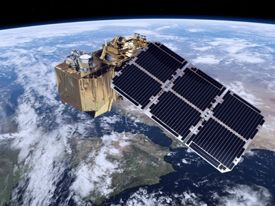
Sentinel-1 Level 1- S1 Tiling
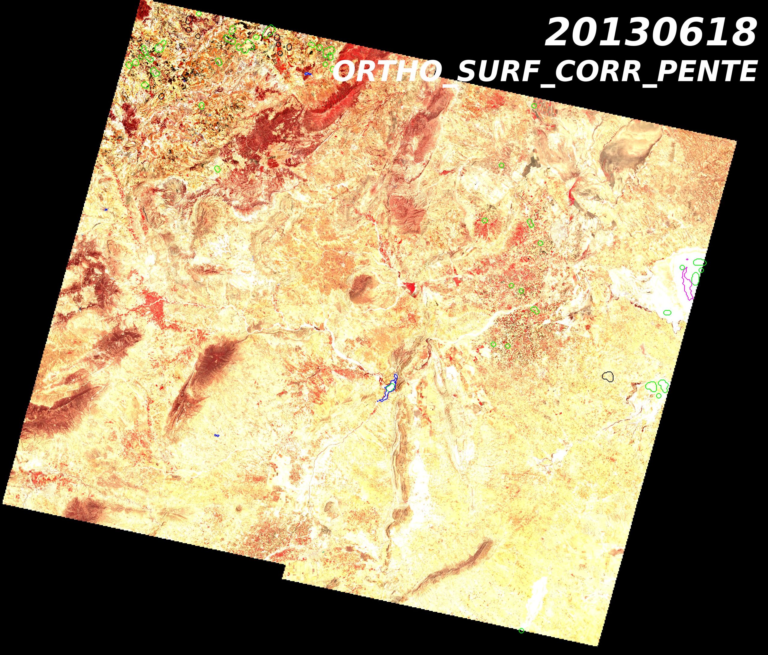
S1TILING L1 products are based on Sentinel-1 Level-1 Ground Range Detected (GRD) products which are ortho-rectified on Sentinel-2 grid to promote joint use of both missions. These products are supplied […]

S1TILING L1 products are based on Sentinel-1 Level-1 Ground Range Detected (GRD) products which are ortho-rectified on Sentinel-2 grid to promote joint use of both missions. These products are supplied […]
At the end of life of each satellite, CNES issues a call for ideas for short-term experiments taking place before de-orbiting the satellite. In 2012, CESBIO seized the opportunity to […]
The products of level 3A provide a monthly synthesis of surface reflectances from Theia’s L2A products. The synthesis is based on a weighted arithmetic mean of clear observations. The data […]
At the end of life of each satellite, CNES issues a call for ideas for short-term experiments taking place before de-orbiting the satellite. Based on the success of SPOT4 (Take5), […]
The Spot World Heritage Service opened in June 2015 with the first dataset about France. Two large areas are covered, between 1986 and 2015 : Multispectral images* covering metropolitan France […]
The Spot World Heritage Service opened in June 2015 with the first dataset about France. Two large areas are covered, between 1986 and 2015 : Multispectral images* covering metropolitan France […]
At the end of life of each satellite, CNES issues a call for ideas for short-term experiments taking place before de-orbiting the satellite. Based on the success of SPOT4 (Take5), […]
The products of level 3A provide a monthly synthesis of surface reflectances from Theia’s L2A products. The synthesis is based on a weighted arithmetic mean of clear observations. The data […]
The Spot World Heritage Service opened in June 2015 with the first dataset about France. Two large areas are covered, between 1986 and 2015 : Multispectral images* covering metropolitan France […]
Le produit SWH 1A correspond au produit historique SPOT scène 1A au format DIMAP (GeoTIFF + métadonnées XML). Il s’agit du premier produit image avec une correction radiométrique qui égalise […]
The “continental vegetation and soils” biogeophysical products of Postel are spatialized variables derived from optical or micro-wave sensors measurements acquired over many years at regional to global scales. Postel Vegetation […]
The “radiation” biogeophysical products of Postel are spatialized variables derived from optical or micro-wave sensors measurements acquired over many years at regional to global scales. The Downwelling Longwave Radiation (W.m-2) […]
Variables biophysiques caractéristiques de la végétation : Le LAI et le fAPAR sont reconnues comme des ECVs (Essential Climate Variables) par le Global Climate Observing System – GCOS). Plus d’informations https://www.theia-land.fr/blog/projects/cartographie-de-produits-biophysiques-pour-le-suivi-de-la-vegetation-sur-la-france-a-20-m-de-resolution […]
Main characteristics of the OSO Land Cover product : Production of national maps (mainland France)Nomenclature with 17 classes (2016, 2017) and 23 classes since 2018, spatial resolution between 10 m […]
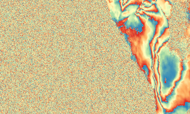
The processing chain outputs rasters of the concentration of SPM estimated in the Bands B4 and B8. The concentration is given in mg/L. So a pixel value of 21.34 corresponds […]
Les produits du Centre Thématique Postel (2000-2008) au sein du Groupement d’Intérêt Public Medias-France sont principalement des produits à valeur ajoutée à l’échelle globale obtenus à partir de différents capteurs […]
Le produit SWH 1A correspond au produit historique SPOT scène 1A au format DIMAP (GeoTIFF + métadonnées XML). Il s’agit du premier produit image avec une correction radiométrique qui égalise […]
Les produits Postel bio-géophysiques « variables de rayonnement » sont des variables spatialisées issues de mesures de capteurs optique et micro-onde, de moyenne résolution spatiale, acquises sur plusieurs années aux […]
Les produits Postel bio-géophysiques « variables de rayonnement » sont des variables spatialisées issues de mesures de capteurs optique et micro-onde, de moyenne résolution spatiale, acquises sur plusieurs années aux […]
SPOT 5 stereoscopic survey of Polar Ice.Les objectifs du projet SPIRIT étaient de constituer une importante archive d’images Spot 5 HRS sur les glaces polaires et, pour certaines régions, de […]
Les produits du Centre Thématique Postel (2000-2008) au sein du Groupement d’Intérêt Public Medias-France sont principalement des produits à valeur ajoutée à l’échelle globale obtenus à partir de différents capteurs […]
Les produits Postel bio-géophysiques « cycle de l’eau » sont des variables spatialisées issues de mesures de capteurs optique et micro-onde, de moyenne résolution spatiale, acquises sur plusieurs années aux […]
Les produits Postel bio-géophysiques « cycle de l’eau » issus de Postel sont des variables spatialisées issues de mesures de capteurs optique et micro-onde, de moyenne résolution spatiale, acquises sur […]
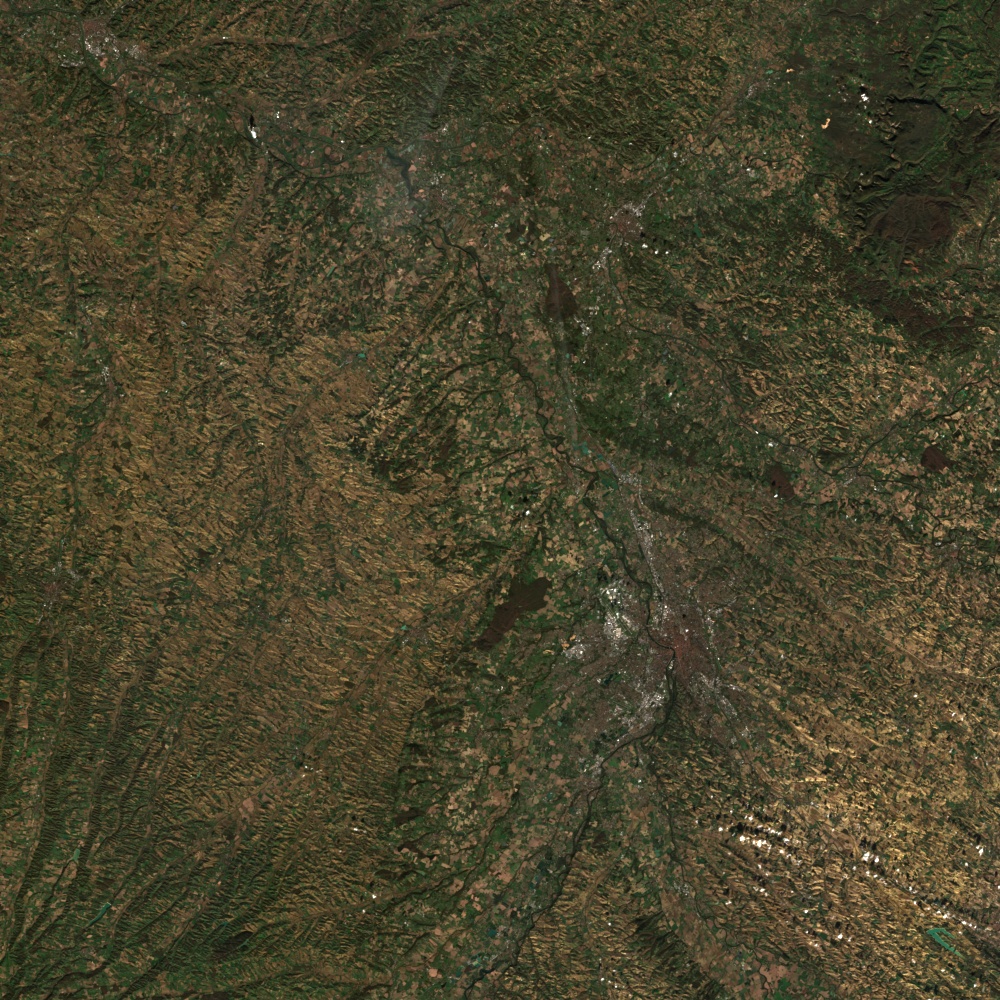
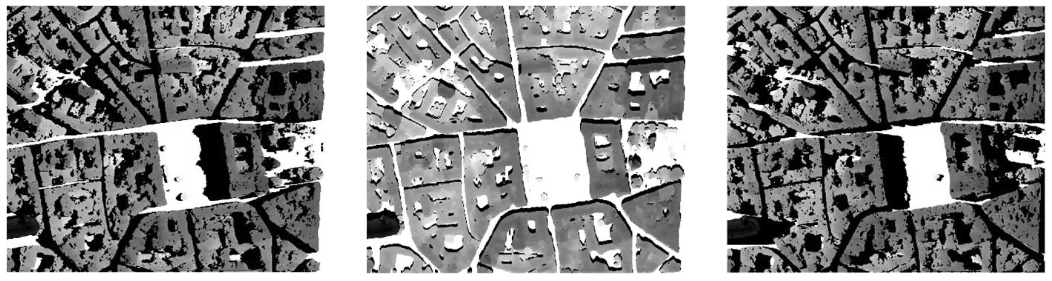
A land cover map associates to each pixel of the surface a labelling characterizing the surface (ex : deciduous forest, agriculture area, etc) following a predefined nomenclature. A commonly used […]
A land cover map associates to each pixel of the surface a labelling characterizing the surface (ex : deciduous forest, agriculture area, etc) following a predefined nomenclature. A commonly used […]
Les produits Postel bio-géophysiques « variables de rayonnement » sont des variables spatialisées issues de mesures de capteurs optique et micro-onde, de moyenne résolution spatiale, acquises sur plusieurs années aux […]
Data ortho-rectified surface reflectance after atmospheric correction, along with a mask of clouds and their shadows, as well as a mask of water and snow.The processing methods and the data […]
Main characteristics of the OSO Land Cover product : Production of national maps (mainland France) Nomenclature with 17 classes (2016, 2017) and 23 classes since 2018, spatial resolution between 10 […]
Les produits Postel bio-géophysiques « cycle de l’eau » sont des variables spatialisées issues de mesures de capteurs optique et micro-onde, de moyenne résolution spatiale, acquises sur plusieurs années aux […]
The Spot World Heritage Service opened in June 2015 with the first dataset about France. Two large areas are covered, between 1986 and 2015 : Multispectral images covering metropolitan France […]
Le produit SWH 1A correspond au produit historique SPOT scène 1A au format DIMAP (GeoTIFF + métadonnées XML). Il s’agit du premier produit image avec une correction radiométrique qui égalise […]
The L1C product contains 2 files : one with the metadata giving information on image acquisition (Instrument, date and time– projection and geographic coverage– Solar and viewing angles), and the […]
Data ortho-rectified surface reflectance after atmospheric correction, along with a mask of clouds and their shadows, as well as a mask of water and snow.The processing methods and the data […]
The Spot World Heritage Service opened in June 2015 with the first dataset about France. Two large areas are covered, between 1986 and 2015 : Multispectral images covering metropolitan France […]
The level 2A products correct the data for atmospheric effects along with a mask of clouds and their shadows, as well as a mask of water and snow.Landsat products are […]
The level 2A products correct the data for atmospheric effects and detect the clouds and their shadows. Data is processed by MAJA for THEIA land data center. Plus d’informations Sites […]
The products of level 3A provide a monthly synthesis of surface reflectances from Theia’s L2A products. The synthesis is based on a weighted arithmetic mean of clear observations. Plus d’informations […]
The level 2A products correct the data for atmospheric effects and detect the clouds and their shadows. Data is processed by MAJA for THEIA land data center. Plus d’informations Sites […]
At the end of life of each satellite, CNES issues a call for ideas for short-term experiments taking place before de-orbiting the satellite. In 2012, CESBIO seized the opportunity to […]
Les produits du Centre Thématique Postel (2000-2008) au sein du Groupement d’Intérêt Public Medias-France sont principalement des produits à valeur ajoutée à l’échelle globale obtenus à partir de différents capteurs […]
The L1C product contains 2 files : one with the metadata giving information on image acquisition (Instrument, date and time– projection and geographic coverage– Solar and viewing angles), and the […]
Les produits Postel bio-géophysiques « cycle de l’eau » sont des variables spatialisées issues de mesures de capteurs optique et micro-onde, de moyenne résolution spatiale, acquises sur plusieurs années aux […]
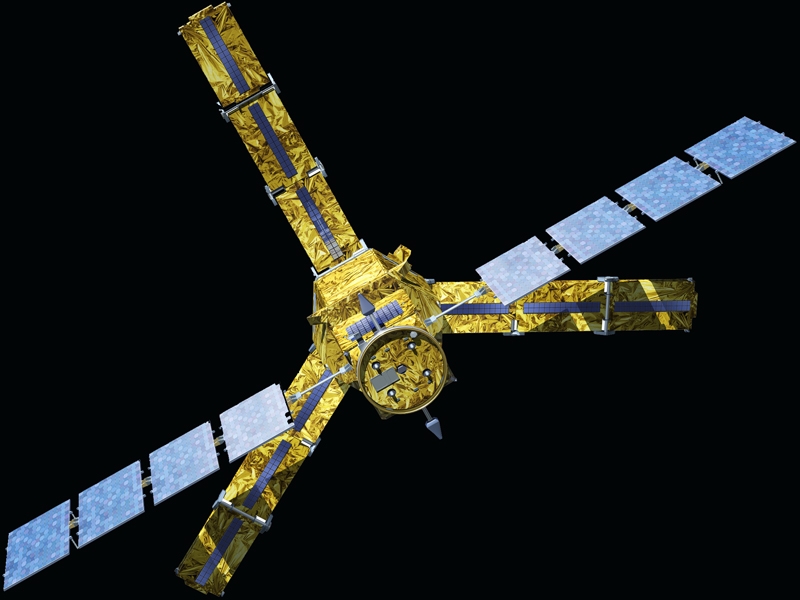
Sentinel-1 Level-1 products are the baseline products for the majority of users from which higher levels are derived. From data in each acquisition mode, the Instrument Processing Facility (IPF) generates […]

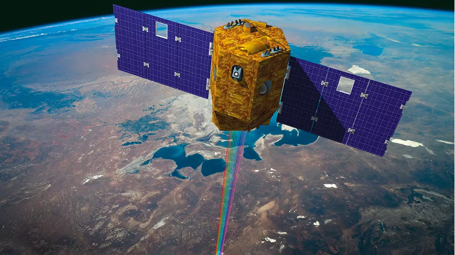
A Sentinel-2 Level-1C Collection 1 product provides orthorectified Top-Of-Atmosphere (TOA) reflectance, with sub-pixel multispectral and multitemporal registration accuracy. Technical quality masks, cloud and land/water are included in the product. The […]

Sentinel-1 Level-2 consists of geolocated geophysical products derived from Level-1. There is only one standard Level-2 product for wind, wave and currents applications – the Level-2 Ocean (OCN) product. The […]
The level 2A products correct the data for atmospheric effects and detect the clouds and their shadows.Data is processed by MAJA for THEIA land data center Plus d’informations https://www.cesbio.cnrs.fr/multitemp/sentinel-2/theias-sentinel-2-l2a-product-format/#English Caractéristiques […]
Bulldozer est un outil permettant de générer des Modèles Numériques de Terrain (MNT) à partir de Modèles Numérique de Surface (MNS) comme ceux générés par CARS. Ce produit a pour objectif de modéliser le sol en […]
Rastertools est un ensemble d’outils en Python dédié au traitement des produits d’imagerie satellite (Sentinel-2, SPOT, Pleiades), largement utilisé par le Lab’OT dans le cadre de ses travaux. Il propose […]

L’objectif de l’Orféo Toolbox (OTB) est de fournir une bibliothèque performante pour le traitement d’images satellites dans le domaine de la télédétection. Créée en 2006 par le Centre National d’Études […]
L’outil INFERNO offre la possibilité de produire une série temporelle d’interférogrammes en utilisant les données radar à synthèse d’ouverture issues de Sentinel-1. Cette chaîne de traitement inclut le téléchargement des […]
DINAMIS, le Dispositif Institutionnel National d’Approvisionnement Mutualisé en Imagerie Satellitaire, propose un large éventail d’images satellitaires optiques et radar. Ces données incluent des images de très haute résolution commerciale (Pléiades, […]
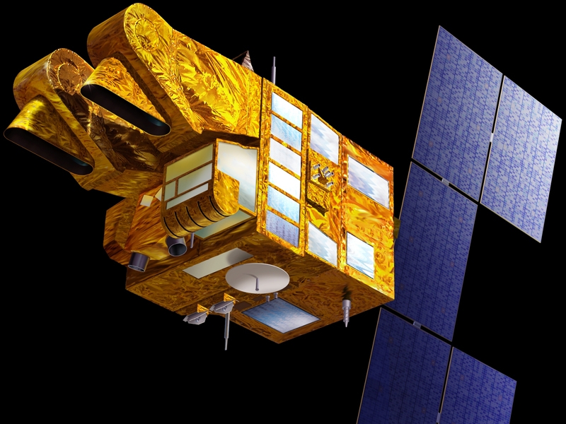
Imaginé et conçu par le CNES, le programme SPOT a vu 7 satellites se succéder depuis 1986, offrant une vision de plus en plus précise de la Terre. Mission Lancement […]
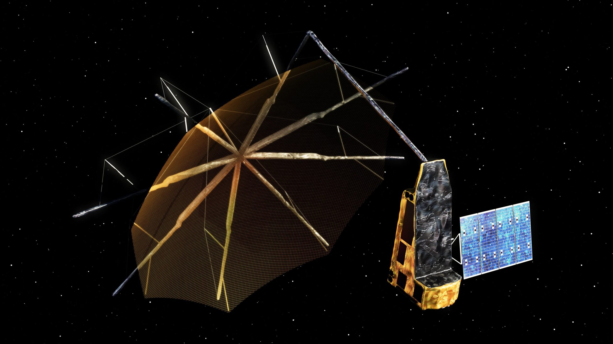
Présentation de la mission La mission SMOS (Soil Moisture and Ocean Salinity) est une mission spatiale de l’Agence Spatiale Européenne (ESA), en collaboration avec le CNES, qui a été lancée […]
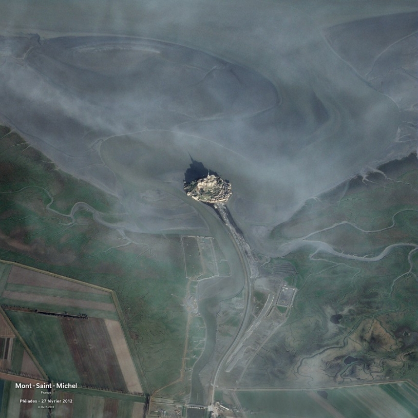
Lancés en décembre 2011 et 2012, les deux satellites du système d’imagerie spatiale à haute résolution Pléiades sont capables de fournir des clichés en couleur de n’importe quel point du […]
Cartographier la biomasse des forêts afin d’estimer les quantités de carbone stockées, telle sera la mission du satellite Biomass à partir de 2025. Mission Lancement Instruments Durée de vie Fiche […]

Les quatre satellites CO3D (Constellation Optique en 3D) sont de petits satellites qui vont cartographier le globe en 3D depuis l’orbite basse, à partir de 2025. Ils répondront aux besoins […]
Présentation de la mission La mission TRISHNA (Thermal infraRed Imaging Satellite for High-resolution Natural resource Assessment) est une coopération entre les agences spatiales Française (CNES) et Indienne (ISRO). Elle est destinée à mesurer environ 2 […]
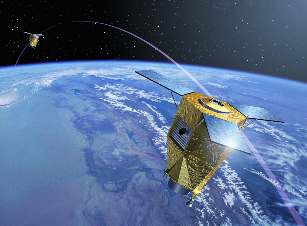
Composante optique du programme européen Copernicus, la mission Sentinel-2 fournit des clichés dans 13 bandes spectrales de l’ensemble de notre planète, et ce, tous les 5 jours. Mission Lancement Instruments Durée […]
Venµs est une mission franco-israélienne dédiée au suivi fin et régulier de la végétation terrestre, notamment les surfaces cultivées. Mission Lancement Instruments Durée de vie Fiche projet Étude de la […]

QUANTICA Occitanie vise à quantifier le stockage additionnel de carbone dans les sols agricoles, un levier essentiel pour réduire les émissions de gaz à effet de serre. Le projet est […]