
MUSCATE Spirit SPOT5 L1A


How to cite :
SPIRIT Collection – SPOT5 HRS DTMs and orthoimages of polar land ice collection.
doi :
Description
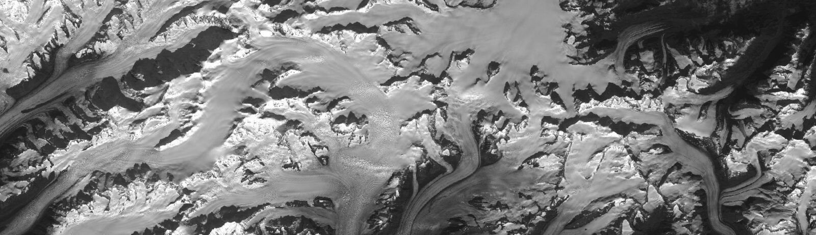
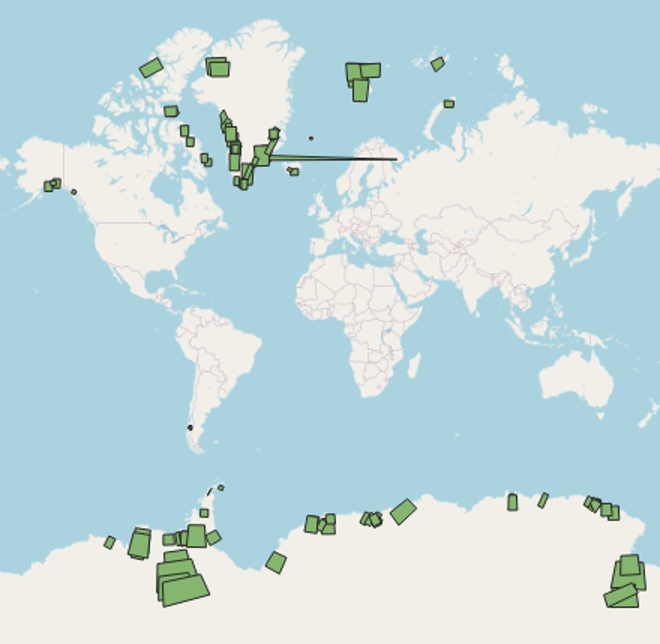
SPIRIT is a collection of 152 SPOT5 HRS DTMs and orthoimages from 2003-2014.
Monitoring the evolution of polar glaciers, ice caps and ice streams is of the utmost importance, as they are a good indicator of global climate change and contribute significantly to the current rise in sea level. Accurate topographic surveys are particularly useful because they reflect the geometric evolution of ice masses.
At the time when these data were created, i.e. in 2007-2009, the accuracy and/or spatial coverage of satellite missions (radar altimetry, ICESat) or field surveys were generally insufficient. The SPIRIT project (SPOT 5 stereoscopic survey of Polar Ice: Reference Images and Topographies) was launched as part of the International Polar Year 2008-2009 (IPY) to improve knowledge of the topography of the polar regions.
SPIRIT enabled the acquisition of a large archive of SPOT 5 stereoscopic images covering most polar ice masses and the delivery of digital terrain models (DTMs) and orthoimages to the scientific community.
Raw SPOT5 stereoscopic images are now freely available through the Spot World Heritage program (link to the SPOT5 HRS 1A collection)
Collection id : MUSCATE_Spirit_SPOT5_1A
Characteristics
| Product type | satellite | |
| Format | raster | |
| License | Etalab 2.0 license | |
| Start of production | 01/01/2007 | |
| End of production | 31/10/2014 | |
| Coverage | -180, -90, 180, 90 | |
| Coverage type | site | |
| Spatial resolution | 40 | |
| Time resolution | N/A | |
| Missions | Spot 5 | |
| Instruments / Captors | hrg1, hrg2 |
Access to products
The collection is disseminated using FAIR principles by the Data Terra Research Infrastructure (Continental Surfaces Data Hub – THEIA) through the diffusion service GEODES hosted at CNES, Toulouse, France.
Further informations (papers)
- SPIRIT. SPOT 5 stereoscopic survey of Polar Ice: Reference Images and Topographies during the fourth International Polar Year (2007–2009) – doi: 10.1016/j.isprsjprs.2008.10.005
- SPOT5-HRS digital elevation models and the monitoring of glacier elevation changes in North-West Canada and South-East Alaska – doi: 10.1016/j.rse.2007.11.004