
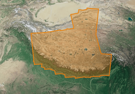
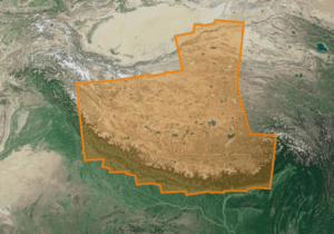
Himalaya and western Tibet – InSAR FLATSIM : Ground Deformation products

This dataset provides high-precision measurements of surface displacements for the Himalaya and western Tibet area. The data is generated using the FLATSIM processing chain, designed for consistent and systematic INSAR analysis at large scale.
This project complements the East Tibet project of the 1st FLATSIM call, with the aim of quantifying the tectonic deformations associated with the India-Asia convergence, from the Himalayan front and across the Tibetan plateau, characterizing lithospheric rheology and hydrological, landslides and cryosphere-related processes. Possible links between the seismic cycle, external forcings and relief construction will be explored. More methodological aspects, such as the quasi-absolute referencing of InSAR measurements, will also be addressed.
Three types of products are made available for each orbit portion processed (see detailed description )
- « INTERFEROGRAM »: this brings together the differential interferograms, wound and unwound, in radar or terrain geometry, filtered or not, at different resolutions, as well as the atmospheric correction maps used and spatial coherence for each interferogram.
- « TIMESERIES »: this includes maps of movement in time series and average speed, according to the satellite line of sight (LOS), and quality indices of time series processing.
- « AUXILIARYDATA »: this directory contains maps indicating the LOS vector, the DTM in radar geometry, at different resolutions, the radar-field geometry transcoding tables, and temporal coherence, as well as a set of figures and parameter files specific to the processing of the time series.
These products feature the data cube of cumulative deformation for each time-step of the series, along with the estimated mean velocity in the radar Line-of-Sight (LOS), provided in either radar or ground geometry. Each interferogram is delivered with an atmospheric phase mask, unfiltered wrapped and unwrapped interferograms, wrapped differential interferograms, and spatial coherence maps. This dataset also provides additional information such as processing parameters, radar-to-ground geometry look-up tables, and traces recorded during the processing.
Plus d’informations
https://formater.pages.in2p3.fr/flatsim/pres_flatsim.html#the-interferogram-packages
Caractéristiques
| Type de jeu de données | data cube | |
| Type MNT | SRTM, DEM Copernicus | |
| Licence | Creative Commons License – Attribution Non Commercial 4.0 International . | |
| Début de production | Oct-2014 | |
| Fin de production | Apr-2021 | |
| Emprise géographique | Himalaya and western Tibet | |
| Type d’emprise | Concatenated IW-SAFEs | |
| Résolution spatiale | N/A | |
| Résolution temporelle | 6 to 12 days according with S1 constellation | |
| Mission(s) | Sentinel-1 | |
| Instrument(s) / Capteur(s) | SAR-C | |
| Métadonnées DataCite | https://commons.datacite.org/doi.org/10.24400/253171/flatsim2020 | |
| DOI | doi:10.24400/253171/FLATSIM2020 |